Monitoring in the Poteau River Watershed, AR
Gallery for the Poteau River Watershed, AR
Follow our research on flickr!

Funding Agency
Arkansas Natural Resources Commission
Project timeline
October 1, 2017 – December 31, 2020
Purpose
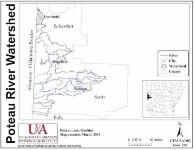
The Upper Poteau River Watershed (UPRW) has been listed as a priority watershed by the Arkansas Natural Resources Commission (ANRC) since 1998 and has received a good deal of focus since it’s a transboundary watershed between Arkansas and Oklahoma.
 ANRC wants to know how management activities in the watershed have impacted water quality, how land use affects nutrient and sediment transport through streams and rivers, and how water quality is changing over time.
Water quality is important in the Poteau River Watershed. The James Fork, a tributary to the Poteau River, provides drinking water for Sebastian and Scott Counties in Arkansas through the James Fork Regional Water District. Lake Hinkle is a nearly-1,000 acre reservoir about 12 miles west of Waldron nestled in the Ouachita National Forest. Lake Hinkle provides recreation opportunities such as camping and hiking, as well as bountiful fishing for bass, crappie, sunfish, and catfish.
Objective
Researchers with the AWRC will collect over 900 water samples during the 3-year study period. Samples will be collected during base- and storm-flow conditions from 13 sites throughout the watershed each month and analyzed for nutrients, sediments, and salts.
Three of the study sites are located at stream gaging stations that provide continuous discharge data and are maintained by the US Geological Survey. At the ten sites where continuous discharge is not already available, we are setting up our own discharge monitoring stations using Doppler system flow meters and pressure transducers to measure continuous stage, or water depth.
Goal
The goal of this project is to help identify areas where previous land management practices have improved water quality. Data will also help to pinpoint areas of poor water quality so the State can target and prioritize resources for continued improvement in the watershed.
This project will also provide the foundation to look at how water quality is changing (or not changing) over time and with water-quality improvement efforts.
Benefit
State and federal agencies and watershed organizations can spend a lot of money on efforts to improve water quality. This project will help water resource managers understand how land use and management activities might affect water quality and to target areas where best management practices can be most effective.
Results from this project can also be used to estimate nutrient and sediment loads and determine water-quality trends over time. Data can be used to validate SWAT Model load estimations and aid in the future development or update of watershed management plans. SWAT stands for Soil and Water Assessment Tool and can be used to estimate how land management activities might impact water quality.
The data that will be collected over the 3-year project can also be used by the Arkansas Department of Environmental Quality (ADEQ) for its assessment of water quality related to the 303(d) list of impaired waterbodies.